Sunday, 2 March 2025

Twin hiking up Mount Brinchang West in Cameron Highland


In our last visit to Cameron highland last year,  we had visited Boh’s Tea Plantation and  Taman Eko Rimba Parit Falls but did not have the time to climb up Mount Brinchang which has mossy forest and giant pitcher plants. As we would be going to Kuala Terengganu to take part in Terengganu Marathon 2025, we planned to visit Cameron Highland first before travelling from Cameron Highland to Gua Musang and then continued on to Kuala Terengganu passing through Tasik Kenyir State Park. As usual we booked to stay at our time sharing hotel, Berjaya Highland Hotel in Kea Farm. We departed from Taiping in late afternoon and took the Simpang Pulai way to go to Cameron Highland. It was almost dark when we arrived at our hotel and coincidently there was a power outage in the hotel. Luckily the power supply was resumed quite fast if not we would have to have our shower with chill water at temperature of 18 degrees Celsius. 

After taking our dinner at the only Chinese restaurant near our hotel in Kea Farm, we retreated back to our hotel to do some review of literature on how to climb up to the peak of Mount Brinchang. There are two ways to climb up Mount Brinchang , with different distance and trail conditions. One of the routes is to walk the narrow and winding tar road near Kea Farm sharing the way with cars going up to Boh’ Tea Plantation and Mossy Forest Park. We decided to climb up Mount Brinchang via a shorter trail but a jungle trail to the peak of Mount Brinchang West based on All Trails apps which I subscribed.   

We drove 4 km from our hotel at Kea Farm to Brinchang following the direction on google map as directed by my All Trails apps. We were directed to go up a hilly road to the trailhead after making a turn from the Clock Tower Roundabout before Brinchang town centre. We did not drive up the hilly road which is also the road leading to a malay kampung. Instead we parked our car at the car park near the Brew house. It is also near to a McDonald Cafe where it is convenient for those who wanted to grab some food for the climb. We walked about 1  km from where we parked our car to the trailhead via the construction site which later crossed onto the hilly road leading to the Malay kampung. The trailhead lies slightly below the water treatment plant by the road side. There is a torn off bandage sign at the entrance to the trail which stated that illegal entry to the jungle will be prosecuted. I wonder how many hikers will heed the notice since there is no security guard at the trailhead. Since this trail is a popular trail to reach the peak of Mount Brinchang West, perhaps the Forestry Department should set up a guardhouse at the trailhead to register and also impose a jungle permit fee if necessary for those hikers who enter the restricted area.

First checkpoint , 1 km from trailhead.
The direction marker is just below the yellow checkpoint plate.

Tr
Trumpet-like flowers could be seen all the way up

Part of the trail was blocked by fallen tree trunks


The trail surface is hard and well stepped on producing a clear trail with no undergrowth in the beginning of the hike. There are quite a number of mosquitoes on the trail and the nuisance was completely overcome after we sprayed our bodies with insect repellent. The trail is clearly marked with directional marker in the form of reflective plate hammered on tree trunks along the trail. After hiking for 1 km we reached the first checkpoint, CP PAK MAT, 1714 m asl. On the way up we could various types of wild flowers especially the trumpet-like flowers. After hiking for another 0.9 km ,we reached another checkpoint, CP MALTA, 1820m asl which has a big cleared empty space suitable for camping. After CP MALTA, we were jubilated and almost shouted out when we entered into the mossy forest which covered quite a big area. It was breathtaking to see the beauty of the surroundings. The ground was covered with thick dead moss making it very soft. We were like walking on carpet but we really wasted a lot of energy trying to pull out our hiking stick which sank deep into the carpet-like trail. Most of the trees in mossy forest are covered with thick moss with various patterns and who ever set foot into mossy forest will surely marvels at the beauty of the oldest mossy forest in the country.

Stunning view of the mossy forest

It is green and moss everywhere 

First  encounter with giant pitcher plant


The climax of our excitement of this hike was the location of the giant pitcher plants among moss covered tree branches. The pitcher is red in colour with black lip and big enough to catch a mouse. I always thought that big pitcher plants can only be located in Sabah and now I am doubtful. Though  this pitcher plant is not the biggest in Malaysia but is big enough to satisfy our appetite for locating wild pitcher plants in our mountain hiking trip.

The trail may look straight forward but there are few junctions which may lead us into the wrong trail. We would just refer to the map of All Trails Apps when we were not sure which way to follow. There were some muddy parts on the trail due to the frequent rain and we had to be careful not to get our shoes totally sucked into the mud. We then reached checkpoint CP UITM at 1952 m asl which is only 0.5 km to checkpoint Mount  Brinchang West. The Peak of Mount Brinchang West is just 200 m from CP Mount Brinchang. When we almost reached the peak we could smell a very strong and pleasant aroma and we were quite confident it was the fragrance of pitcher plant's flowers. But we were wrong as we later found out that the aroma was in fact from flowers of a wild orchid. On the Peak, there are many pitcher plants of different varieties. The cups of the red pitcher plants are even bigger than what we saw in the mossy forest on our way up. It is not easy to see flower of pitcher plant but we were lucky to locate the flowers of two species of pitcher plants on the peak. Flowers of different species of pitcher plants are different in structure and  fragrance. Except the amazing pitcher plants and wild orchid, we could also see the peaks of distant hills and panoramic view of Brinchang town below. After snapping some photo with the signature signboard written with “Peak of Mount Brinchang West, 2005 m asl”, we began to make our descent to the trailhead. 

The largest cup of the red pitcher on the peak

Flowers of red pitcher plant 

Yellow pitcher and its flowers

Orchid which produces strong and pleasant aroma


The hike was considered an exploratory hike as we had no guide in our hike and we were lucky the weather was fine throughout our hike up and down the hill. Throughout out our hike we did not encounter other hikers maybe because it was not a weekend. After we came down to the trailhead only I realiased I had suffered a cut which had stopped bleeding by tree branches even though I was wearing long sleeves’ shirt. Actually the trail passing through the mossy forest is not easy at all as there were fallen tree trunks blocking the trail. We  either had to climb over the tree trunks or sneak through the narrow space below the fallen tree trunk. We were happy that we had added another peak in the list of mountains we had conquered. 

Panoramic view of the town of Brinchang from the peak

4.3 km from trailhead to peak


Thursday, 31 October 2024

Hiking up Machincang Peak in Langkawi

Jubilated for reaching the peak of Machincang

I have never heard of Mount Machincang in Langkawi until Seok Wan and I visited Telaga Tujuh Resort. It is really a spur of the moment decision to hike until the peak of Mount Machincang at a height of 701 metre above sea level because our initial plan was just climbing the long flight of concrete steps to reach the waterfalls.

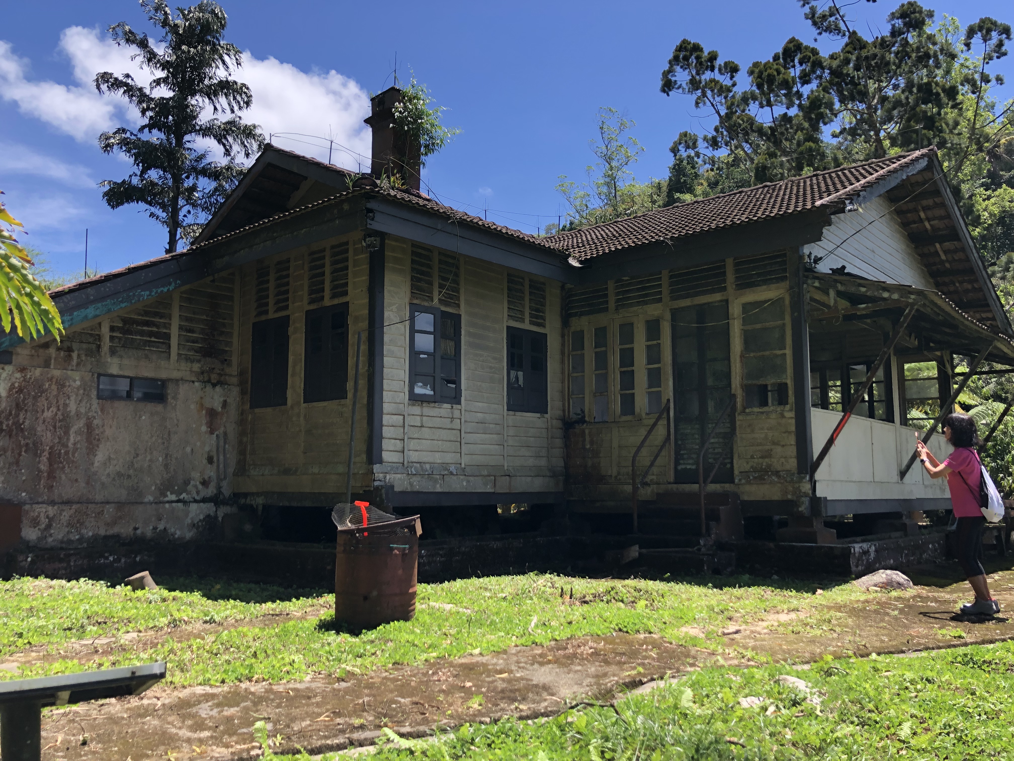
We visited Langkawi Island after running the Kangar City Half Marathon in Kangar with the aim of just relaxing at Chenang Beach for two days before we headed home. After one day at the beach we decided we should venture out to explore the lush green forest of Langkawi Island. We have heard about the beautiful waterfalls and pools at Telaga Tujuh Resort or Seven wells Resort and decided that we should not miss it. We drove from our hotel at Chenang beach after taking a heavy breakfast provided by the hotel to Telaga Tujuh Resort about 18 km away. We arrived at the resort around 11:00 am and would have ample time to see all the waterfalls and pools in the resort. At the car park the parking attendance told us that we should be able to see all the waterfalls in the Park within 2 to 3 hours including a swim in one of the pools. We asked the car park attendance about the signboard showing the route to Mount Machincang and were told that we might need a jungle guide if we wished to climb until the peak of Mount Machincang. So we are contented with just visiting the waterfalls. We had to pay RM 5 to enter the park and registered online to sign in while entering and sign out when leaving the resort. The ascending route is marked from level one to level seven with waterfall at level 3, 4,5 and 6. The waterfall at the lowest level is only 15 minutes of walk on concrete stair from the registration counter. The waterfall at level 3 is the tallest with water dropping from a height of roughly 10 m followed by a smaller waterfall which flows into a small pool suitable for swimming. As it is raining season the waterfall is quite powerful and poses a real stunning sight. There are many big boulders at the base of waterfall and very slippery. So it is pertinent to be careful while walking on the big boulders. 

Magnificent two tiers waterfall at level 3 

We spent about 10 minutes at level 3 just admiring the beautiful waterfall without swimming before we walked back to the registration counter to ascend the concrete stairs to the campsite at level 4. The campsite is complete with toilet and changing room and few huts. There is a small waterfall with water flowing on smooth boulder into a nice pool. This is the pool where most picnickers will have a dip in it. Beside the pool there is another pool resembling a well but not suitable for swimming. The river basin here can be seen more clearly from higher ground by walking up to the bridge-like iron platform above the river or observation bridge.                                                


The observation bridge

Long pool and the  natural well

The concrete stair ends here at the campsite and the  pools at level 5 and 6 can only be reached by walking the jungle trail. As the trail to the pool at level 5 known as the Green Pool is  not clearly marked, we decided to skip it and proceeded to the pool at level 6 known as the Blue Pool. We have to cross the shallow stream on to the jungle trail leading to the Blue Pool. After  25 minutes walk we saw a blue Pool signboard. Blue pool consists of a small waterfall with a small pool. The water is crystal clear with light blue colour and some small fish can be seen swimming in the water. This is the most popular spot for hikers to have a cool dip or swim but the pool is too small to accommodate more than 5 people. When we arrived there were a group of young foreign tourists in the pool and an Indian couple are waiting for their turn to go into the pool. We just walked into the shallow part of the pool to have a feel of the chilling water before we settled down at the pool side for some snack which is also our lunch. I am not really a good photographer but were asked to help taking photographs for the Indian couple and later on two young European girls in their bikini in the pool. 

The pool and observation bridge at the campsite 


Blue pool with has light bluish water

After we finished our lunch it was only 12:30 pm and we decided to walk for another hour uphill before we turn back. The trail was easy to track and before long we reached Kem Saintis ( scientists’ camp) which is just a hut for hikers to take a rest. The hut is not well maintained as evident from its broken roof. 

The height of the peak of Telaga Tujuh should be 106 m above sea level as measured by garmin watch


We were not feeling tired as the trail is not steep and we continued on until we reached Camp Tok Ayah. Further on we saw a signboard stating that we are 30 m to the peak and we thought perhaps the peak is near though definitely not  701 m above sea level. We were quite excited that we are going to conquer Mount Machincang very soon but totally bewildered when we reached a spot with a signboard stating that we are at the peak of Tenaga Tujuh. We met a middle age Russian Couple there and they too did not believe that they had reached the peak of Mount Machincang. Later I saw a small direction marker on the ground directing us to turn left which is going downhill. So after more than one hour of hiking I guessed we only managed to reached the peak of the seven wells waterfall or the source of the river to the waterfall which flows downhill to seven pools below totalling 91 m in height. I might  be wrong because there is absolutely no water source to be seen or heard. Perhaps the resort authority should improve on the signboard by explaining a bit more about this location. Besides that there is another signboard asking the hikers to make a U-turn downhill because hiking further uphill by turning left required an experienced jungle guide. As it is only 1:30 pm we together with the Russian couple turned left in our attempt to reach the peak of Mount Machincang totally ignoring the requirement of a jungle guide. Actually it is not necessary to have a jungle guide as the trail is clearly marked with long rope all way to the peak. The trail is going downhill in the beginning and before long we had  to ascend with steep climb. The Russian couple decided to give up when they are not confident to climb up a steep section on the trail as they are not wearing sports shoes. I had difficulty climbing that section too and had to climb up from the side so as to cross over into the original trail.

At the Peak of Telaga Tujuh , 91 m from the base 


We bid goodbye to our new acquaintances and continue on with our hike uphill. The trail along this trail is very challenging with a lot of climbing on rocks and sometimes squeezing ourself through the narrow gap between rocks. Luckily there is rope along the trail to help us in our ascend and descend. 

A very challenging climb


Walked past this beautiful solitary hill  

The most scenic spot with strong wind 

The sea and sky bridge could be seen 

On the Peak of Mount Machincang


On our way up we saw a giant rocky cliff in front of us and we had to climb on the trail by the  side of cliff to ascend. This part of the trail is quite scary with strong wind but there is a particular spot where we could see the cable cars and sky bridge on the distance hill. Besides that we could see the sea and some small islands below. After 1.5 hours of gruelling hike we finally reached the Peak of Machincang. The peak is just a small patch of flat land. In fine weather we should be able to have a 360 degrees panoramic view of the sea and islands below . Unfortunately we are unable to see anything downhill as the peak is enveloped by thick mist . We did not stay long at the peak as it already 3 pm as  we did not want to descend the hill in the dark. 

The descent was more difficult because we need to be very careful with our steps and we had to keep holding on to the rope for own safety.  We were very lucky there is no rain on the steepest part of our descent as the trail and rocks would be slippery and risky. Furthermore we were only wearing our jogging shoes which may not have enough grip. We only encountered the rain when we had passed the peak of Telaga Tujuh where the trail can be descended with normal walking. When we reached the  entrance of the resort it was almost 6 pm . We spent almost 7 hours in our hike to the peak of Machincang which normally only takes about 6 hours for most hikers. Total distance covered was 10.5 km according to my Garmin watch.

elevation of our hike 

Route of our hike


We are glad that we managed to conquer another mountain after Bukit Pantu in Lambir National Park in Miri. This is really the toughest climb ever for us in our hiking adventure. We managed to see some rare flora but hardly any fauna except the leeches which had given both my legs several bites . I  only realised it after we had reached the foothill. We are totally satisfied with our visit to Telaga Tujuh Resort and our only regret is not able to visit the green pool at level 5. 

Mount Machincang is only the second highest mountain in Langkawi and if we were to visit langkawi again we will definitely go for the highest mountain , Mount Raya where there is no jungle trail but walking up 4287 concrete steps known as Thousand memories eagle stairs ( Tangga Helang Seribu Kenangan) to the peak.

The three highest mountains in Langkawi 


Sunday, 5 March 2023

Treasure hunt 2 on Bukit Larut


Debut hike to the highest point on Maxwell Hill

On 16 Feb 2023, 9:00 am we set out on our exploration journey to Maxwell Hill  to continue with our uncompleted mission of locating and inspecting  the old bungalows on  Maxwell hill. As it was a Sunday there were quite a lot of hikers going up the hill mostly until the stations  at 2 km or 3.2 km. We walked all the way from the foothill until tea garden at 5 km without stop. As we did not check  the interior of the guest house at Tea Garden in our previous trip, we decided to take a closer look at the inside of the guest house this time. The interior is in a deplorable condition with some collapsed wooden floor planks , spoilt furniture and damaged built-in kitchen cabinets. Just wonder how those newly installed furniture and flooring could be damaged so easily. 
The broken wooden floor of Tea garden guesthouse

The Tea Garden got its name because it had a small tea plantation  during the British colonial era. Formerly, Tea Garden was the first Jeep Station where visitors could disembark to see the landscape and flora half way up the hill. Actually the main attraction at Tea Garden is the beautiful waterfall just 500m away up the tarred road.  In my opinion,  Tea Garden can be revived by planting either tea or coffee in a small scale just like old times besides restoring the guest house once again.  In fact there is a small camping site with cement floor beside the building and that can be promoted and utilised too.

After a thorough scrutiny of the dilapidated guesthouse we continued with our hike until the waterfall with the intention of taking a short break but the place was occupied by a group of hikers.  As a result we changed our plan and took our break a short distance further uphill. Before long the group of hikers at the waterfall came up and we greeted each other which is a common practice among hikers. We started our conversation only to know that they were from Penang and planned to hike until the hill station only. We hiked up together and further up the hill we caught up with another group of hikers.

A common impatients found at 700m height


A rare Impatients Curtisii found at 900 m height


Coincidently two of the them are the researchers and exhibition narrators  of " A tale of two hills " exhibition still in progress at  Maxwell Basecamp at the foothill. They are from a group of eight researchers doing detailed studies on the flora and fauna of Penang Hill and Maxwell Hill. As I had visited the exhibition, I knew that they had found a rare flower plant, impatiens curtisii,  which can only be found on Maxwell hill at 900 m height. In fact, their hike today is their field trip to take more pictures of the rare impatiens curtisii to see how wide spread the plant is. The plant is a specie of balsam plants whose seed will burst when ripe making it hard to be  propagated faraway from the mother plant. Besides impatiens curtisii  which is pink with white patches, there is another impatiens species  purple in colour and can be found easily at 700 m height on Maxwell Hill. 

We did not stop at the hill station to have our lunch like we usually do as it was still early. We just used the public toilet which is clean but the flush in the man's toilet is spoilt.  The woman's toilet is in good condition according to Seok Wan. There is a tap outside connected to a long hose so I had to flush the toilet using water from the tap outside. We did not stay long at the hill station as we had four old bungalows to locate. Our first bungalow is The Hut Bungalow ( Rumah Rehat Cendana ) which we passed by in our previous trip but did not enter. 
The wooden balcony of Hut Bungalow

Neat and tidy interior of The Hut Bungalow

Staircase to the Hut Bungalow

The Hut Bungalow is situated on higher ground from the tarred road so we had to climb up a flight of  concrete steps to reach it. The bungalow has a big  balcony made of wood  which is not safe to step on. We did not venture into the balcony but we went up to the wooden verandah extended from the side of the bungalow. The verandah is in better condition but we were still very careful with our steps. From the side verandah we could have a panoramic view of a  beautiful terraced hill below which was developed for cultivation and a big lake which looked like a reservoir. The reservoir maybe the Air Kuning Reservoir of Perak water treatment plant which supplies drinking water to Taiping residents.  The inside of the Hut Bungalow is surprisingly clean and tidy. It does not look like it has been left vacant for many years. By repairing the wooden balcony, some touch-up of the side verandah and clearing of the overgrown grass around its compund,  the bungalow should be good enough for holiday makers to spend a night or two.

The operator who operated Cendana Bungalow as a rest thouse was also involved in the planting of Tulip at the vacant land in front of the bungalow at one time. The tulip cultivation project was quite successful and  a  varieties of beautiful tulip flowers had produced their beautiful blooms. The tulip garden had managed to pull in a lot of tourists to Maxwell Hill solely to look at the tulip flowers.  A pity the Tulip Planting Project was abandoned a few years later making Maxwell Hill less appealing to tourists. Maybe the project can be revived by planting other highland crops which is easier to cultivate such as  strawberry, Honey Dew, grape which are equally appealing to tourists. 

At the entrance to Speedy's and The Nest Bungalows
ss


After visiting the Hut Bungalow we returned to the main road and hiked towards the telecommunication towers  at the peak of the hill.  After walking about 1 km , we reached  Speedy's Bungalow or Speedy's Chalet. It is also called Rumah Rehat Gunung Hijau. The Bungalow was not renovated even though it was part of the  Biodiversity Research Centre where herba plants were planted on an experimental basis. The Biodiversity Research Centre occupied  a big piece of flat land but is now in a ruin with bushes growing wild. The herba garden should be revived by seeking technical help from more established  herba garden operator so that it will not be a failed project again. 

Speedy's Bungalow / Rumah Rehat Gunung Hijau

Side view of The Nest Bungalow

Speedy's Chalet is strategicallty located on slightly higher ground than the main road and from the front of the bungalow we could have  panoramic view of the landscape below. There are a few granite boulders overgrown with green algae lying below the  pine trees on the slope to the bungalow. The condition of the bungalow was partially run down with two miserable wooden sofa benches indicating long period of neglect. 

The front portion of The Nest bungalow

The Nest Bungalow, a private bungalow owned by the Methodist Mission is situated above Speedy Bungalow but it is slightly below the  Box Bungalow on the same ridge. We had to walk a flight of concrete steps and a short jungle trail to reach the Nest Bungalow. There is a wooden gate leading to the bungalow which was built on concrete stilts. The trail from the gate to the front door of the bungalow was elevated by a line of tree trunks indicating that the trail would be soggy during raining season. The bungalow is well maintained but the back portion of bungalow looks old and dirty. It has a side verandah with roof and an open kitchen cum dinning room facing an empty plot of land most probably an abandoned garden. The Nest Bungalow was once reputed to have a beautiful garden as it was always occupied by members of the mission.


The Nest Bungalow was occupied by a couple who are nature lovers  from 2016 to 2019 before they  moved down to Taiping town due  closure of the Hill after some serious landslides on the hill slopes. It is the third highest bungalow on Maxwell Hill at 1200 m. There is a marked trail in front of the Bungalow used by ultra trail runners but I am not sure where it is leading to. As it was already more than 1:00 pm after we had finished inspecting the Nest Bungalow and its surrounding, we settled down to have our lunch. Our lunch consists of packed fried koay teow and we had the luxury of eating our meal in the open dinning hall of the Nest bungalow as its uninvited guests. The dinning hall is equipped with table and chair but a bit dusty. There was no water from the tap which was locked by the tenants of the bungalow while vacating it.

After finishing our lunch we proceeded uphill to conquer the peak of Maxwell Hill. We met with the  group of researchers we met earlier a short distance above Speedy Bungalow. There had found a few impatiens curtisii plants by the road side and kind enough to show us the location of the plants. While they were immersed in their observation and study on the rare plant,  we proceeded with our hike towards the peak. The peak of Maxwell Hill at 1376 m in height and 13 km from the foothill is the location of the highest Bungalow, The Cottage bungalow presently formed part of  the telecomunaction towers station. The Cottage Bungalow  was once the private residence of the first Resident of Perak , JJW Birch.  It is contructed by granite  quarried at the foothill which explains why it  is still solid and in good shape as can be seen from outside the fence of the locked telecommunication towers station.  As outsiders, we are not allowed into the telecommunication towers' compound so we were unable to get a glimpse of the interior of bungalow. It is presently being used as the office and worker's quarter of Telecom staff . 
 
The Cottage bungalow inside Telecommunication Towers Station

A small hut outside Telecom Towers


We were really delighted that we had finally located all the bungalows on Maxwell Hill. As the entrance to Gunung Trail was just nearby and it is still not too late to make some more hiking, we decided to try out the jungle trail to Gunung Hijau at 1449 m which is the highest among all the hills of larut hills. The trail from the tarred road to the peak of Gunung Hijau is about 2 km and needs at least 2 hour for a round trip. We did not intend to hike until the peak but just wanted to experience walking a short distance on the trail and looked for pitcher's plant which was said to grow on Gunung Hijau. It is all downhill in the beginning of the hike and the trail was quite difficult to trek as it was thick with fallen  leaves and branches. We had to bend our body to pass through fallen tree trunks  blocking the trail at a few locations. In fact the trail is quite risky as it is  narrow and on the brink of the hill slope besides its thick undergrowth. When we reached a two-ways junction leading uphill we were not sure which trail to follow as we could not find any ribbon marking which we saw in the beginning of the trail. We had walked about 300 m on the trail and thought it was good enough if just to have a feel of trying out this less navigated jungle trail.  We were very fast while returning to the tarred road perhaps wary of the hidden danger on this trail.  Glad to be out of the trail but discovered that there were  leeches on our legs and shoes even though we had sprayed our shoes and legs with salt water. This trail is notorious for leeches and perhaps that is the reason few hikers dare to attempt this trail to Gunung Hijau.

It was almost 3: 30 pm when we returned to the tarred road. After getting rid of the leeches on our legs resulting in bloodied socks and legs we headed downhill without delay. The weather was a bit hot and so we did not experience the usual thick mist on the hill. We met two hikers at the hill station who quite often hike until the hill Station. One of them had reached the peak of Gunung Hijau before and he told me that we might not had enough time to reach the peak of Gunung Hijau at this hour if we were to attempt as the hike needs two hours round trip.  In view of the unmarked and leech infested trail, we will temporarily forget about conquering the highest peak of Larut hills.

On our way down from hill station, we detoured to have a look at the oldest hill temple, Kaliamman Hindu Temple roughly 50 m from the main road. The temple looks new as it has recently been renovated and well taken care of. We saw the caretakers who had travelled up to the temple by motorbike to do some repair works at the temple and I praised them for managing the temple so well.

Besides the temple there is a block of building which was completed many years ago and thought to be the hostel of the Hindu temple. In fact it does not belong to the Hindu temple but most likely a government project. I come to understand that it is a guesthouse with can accomodate 70 guests per night. The place was usually locked but we were lucky this time that the long grass had just been cleared and the workers forgot to lock the gate. We went inside its compound to take a few snapshots of the white elephant project. The smell of swift dropping was very strong and suffocating when we went closer to take a peep into the inside of the building. So this guesthouse has been housing swift since its completion instead of receiving guests. Beside dirty wall and foul smell  the  building as a whole does not suffer structural damage and can be brought to its originality by just cleaning up and new coat of paint. Maybe the ceiling needs to be replaced if the stain left by the swift is to hard to clean up.


The completed and abandoned guest house near Hindu Temple

Even though it is easier and faster going down the hill but I still experienced  fatigue and thirsty as we we did not bring enough drinking water. We took 3 hours to reach the foothill even though I jogged at certain part of the road where it is less steep. By the time we signed out from the guard house it was already 6.30 pm. My Garmin watch showed 30.16 km and 9:19:12 and this is our longest hike in term of distance and time. Seok Wan had achieved two first in this hike that is 30 km finisher,  and  summit conquest of Maxwell hill at 1376 m. 

After locating all the bungalows and inpecting most of them in two sundays in row, we realised that those old bungalows mostly more than 100 years old with the exception of a few, are in various degree of deterioration. The buildings are our heritage buildings which should be treasured and preserved. So I sincerely hope the authority given the trust to manage the old bungalows must immediately come out with a  solid plan to refurbish and bring back to life all the heritage bungalows on Maxwell hill.

Thursday, 2 March 2023

Treasure hunt on Bukit Larut


For two Sunday in a row, Seok Wan and I embarked on our self-mooted treasure hunt on Larut Hill. Our treasure in this case refers to the old bangalows  and rest houses on the hill. Besides three bungalows which had been renovated and suitable for occupancy the rest are left as it is for many years. Our aim is to locate all the bungalows and rest houses to check on its condition. The only transport up the hill which is by jeep has stopped its service since 2019 due to serious landsides at many locations along the tarred road but that is not our concern as we had planned to hike up to the peak of the hill. 

We started our hike on 19 Feb 2023 at 10:30 am on tarred road so that we could reach the summit early. The first building we reached was the tea garden guest house at 656 m height or 5 km from foothill. The building is in bad shape with falling roof and badly damaged interior. The building is really a white elephant project as a lot of money was spent in renovating the previous old building which was crumbling. A pity that the building has never been used and the management should explain to the public the reason behind it. As far as I know not many people know about its function as almost no publicity was done to promote it to Taiping folks and tourists.

The multi-storeys high waterfall at 6 km


Luckily our sombre mood after seeing the deplorable state of the  tea garden rest house was lightened  by the view of the magnificient waterfall after 500m of walk uphill. This was our first stop to have our snack . We sat by the road side refueling ourselves and enjoying the beauty of the towering waterfall which is easily five storeys high. Ten minutes past and we continued with our hike to the next bungalow,  Permai view rest house  ( Rumah Rehat Sri Permai ) which is just a short distance below the hill Station. It is only a medium size bungalow and its condition is not too pleasant to look at though structurally it is still intact. We did not manage to look at its interior as it was locked.  In my oponion this bungalow just needs a proper clean up , some minor repair and a new coat of paint to make it presentable to visitor. At the moment I wonder how many tourists really walk up the concrete stairs to take a closer look at the bungalow.

Permai View Bungalow

Rumah Rehat Beringin

On our way to the hill station or commonly called summit of Maxwell Hill at 1036 m height or 10 km from foothill,  we passed by the wooden hanging bridge and the observing tower which are all in the state of crumbling and are probihited from entering. The hill station is the nucleus of Maxwell Hill with three bungalows and few workers' quarters, public toilet , a cafe and a prayer room.  The public toilet, cafe , Federal Bungalow ( bangalo Angkasa ), and Bungalow Watson ( rumah rehat Beringin ) had been renovated before and are still in good condition.  In fact Rumah Rehat Beringin was serving as a guesthouse which offers bunker bed for solo traveller. 

Maxwell Hill Bungalow

Cafe and Jeep Station at Maxwell Hill


Rumah Rehat Angkasa was a western style bungalow with a fire place and is opened to group booking at a rate of Rm 600 per night. The other bungalow is Rumah Rehat Bukit Larut ( Maxwell Hill Rest house ) which is a big bungalow but its condition is very bad with foul smell from swifts dropping. Its kitchen is quite dark and has become a conducive dwelling place for swifts. When we approached the doorless kitchen, we were shock by the flock of swifts flying out from it. The condition is so bad that it may need a hefty sum to restore but no matter how this bungalow must be restored first due to the significant of its name , Maxwell Hill Bungalow. 

Federal Bungalow 
Interior of Federal Bungalow

The worker's quarter of Maxwell Hill Bungalow was a stand alone wooden house named Rumah Delima. It is situated behind Maxwell Hill Bungalow slightly on higher ground. There is only a single broken bed in it and some of the wooden planks making its floor had dropped. The place looks a bit eerie and once a you-tuber group had come to this house to film the inside of the house at night trying to record for strange sound. I  really salute them for their gut and bravery. There is another wooden worker's quarter behind Rumah Delima but the path to it was covered with bushes and we did not go closer to take a proper look.  

Rumah Delima , a worker's quarter

An isolated hut behind Maxwell Hill Bungalow

Roughly after 500 m uphill from the hill station, we came to a junction with a big Sri Kayangan signboard.Turning left will lead us to three bungalows which we discovered later as this was our first hike along this  road until the end of the road. We skipped the first bungalow which was the location of the once famous Tulip farm but had long been abandoned. The road had just been resurfaced and was very quiet . It is so peaceful and cool along this stretch of road and we encountered no one along this stretch of road. After roughly 1 km we came to a nice bungalow on a slope. It is  Banglo Tempinis or Treacher's Bungalow which can be reached after climbing some concrete steps. This beautiful bungalow had been renovated before and was opened for booking at a rate of RM 600 to group booking. The landscape around it is breathtaking with many big granite boulders and pine trees decorating its garden. The biggest boulder is fixed with a hanging iron ladder for visitor to climb up to its top to have a better view of the hill. This bungalow is undeniably a premier  lodging place  to enjoy the serenity and beauty of the hill. 

Tempinis Bungalow
A beautiful Tempinis Bungalow

Big Granite Boulder with ladder

The final Bungalow along this road is the Box Bungalow or Rumah Rehat Sri Kayangan at 1242 m height.  The telecom towers and Gunung Hijau are clearly visible from here. Its front portion is small and resembles a box but it is still quite a big bungalow. It has not been renovated in recent time and was surrounded by lallang with some blood thirty leeches. We walked around its compound and peeping into its interior only to find a pool of water on its floor signifying leaking roof. Its hall is almost empty and the back portion is definitely an ugly scene. In fact the bushes around the bungalow had recently been cleared maybe by the ultra trail run organisers as the runners will run through the jungle trail from this bungalow until the Hindu Temple at the foothill. This bungalow should be renovated as this is the highest bungalow still available for booking if it is in good shape. The highest bungalow, The Cottage is no more available to the public as it has been taken over by telecom to be used as its office and worker's quarter. 

Delighted that we had reached The Box Bungalow
The Box Bungalow in pitiful state


Caulfield Hill and Gunung Hijau seen from the box


The mist has enveloped our way downhill

As we were going downhill from the Box Bungalow the hill was suddenly covered by  thick mist signalling rain was  on its way. We were right as the rain just came pouring down a short moment later and we had to put on our raincoats to avoid suffering from cold later.  As it was getting late and we did not want to reach the foothill too late we decided to explore the other bungalows not yet visited some other time. We walked quite fast while going downhill as it was not so tiring going down the slope. The rain only stopped when we reached the waterfall near tea garden. The rain was heavy but without strong wind. We would surely be worried if there were strong wind that could uproot trees and cause landslides. When we reached the foothill it was almost 5:30 pm .The hike up and down the hill took 7 hours 15 minutes covering a distance of 23.4 km with an ascent of 1249m.