Tuesday 4 December 2018

A very wet Penang Bridge International Marathon 2018

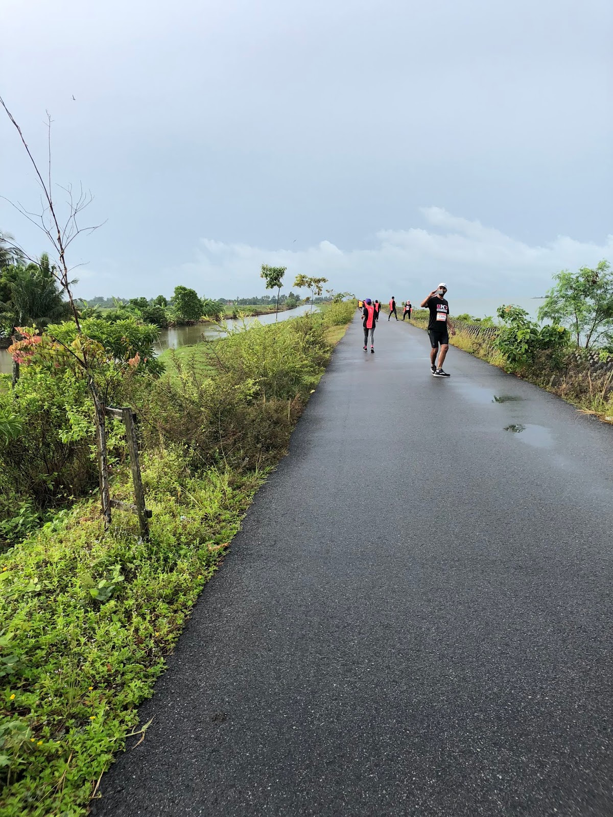
Route for Penang Bridge Marathon 

On 25/11/2018 it was our annual Penang Bridge International Marathon which I had participated since year 2011. I registered for full marathon even though I was informed during registration that if I finished the run more than 7 hours I would not receive my medal and finisher tee. My finishing time last year was 7 hours 18 minutes, 18 minutes more than the official cut-off time but I still managed to get my finisher tee and medal which were sent to me by courier after my appeal to the organiser. I registered this year though it is quite likely my time will exceed 7 hours and get nothing because I really enjoy running on the bridge which is only deserved for us participants once in a year. Seok Wan registered for half marathon.

We planned to go early in the morning on 24/12/2018 to get our running bibs so that we have enough sleep in our time sharing hotel, Georgetown city hotel which is quite far from the starting venue. Due to Seok Wan's dilly dally over household chores we only managed to reach Queensbay's mall around 2 pm. By the time we finished our lunch at KFC it was almost 3 pm. After collecting our bibs I had another errand to complete before I could proceed to the hotel. I had to sent my mum's medicine to my sister 's house at Sunway Tunas not far away. 
Very smooth collection of running bibs

After we had checked into our hotel, it was already 5:30 pm. We tried to get some sleep but ended up chit-chatting on bed until dinner time at 7:00 pm. We walked to a nearby hawker centre to have our dinner. I thought at first to have fried rice for better carbon loading but ended up ordering fried koay teow which was not the best option before a full marathon. After dinner, Seok Wan insisted that we walked to Gurney plaza 1 km away to buy a t-shirt as the base for her running singlet which was too revealing. After returning to  our hotel for some sleep I only realised that we had only the most 1 hour to rest. Luckily I had one hour of quality sleep before we headed to the starting venue some 12 km away. I had to rely on my waze to lead us to the parking site near Sungai Nibong Bus station. I ended up parking my car at the parking  lot of a hawker centre where I was charged RM 10 by a group of locals who hijacked the place as their own property. I had no choice as it was difficult to find free parking lot. When I finished parking I was shocked  to realise that the time was  already 1: 00 am or 30 minutes to my full marathon start off. We were almost 1.5 km away from the starting point so I had to jog slowly to the starting point leaving Seok Wan behind. Her half marathon would only start at 3:00 am and she did not have to rush.  Luckily I still managed to reach the back of the full marathon participants already gathered with just 5 minutes left before the gun off. So the 1.5 km jog was perfect as my warming up before the marathon. 

Full Marathon Participants waiting for the start-off

As I have recovered from my persistent heel pain which was with me for more than a year I could run faster but I still maintained a pace of 8 min per km. I did not stop at the first two water stations as I could drink from my bottle filled with energy solution. I had only one small bottle with me as I had dropped the other one into a big drain while easing myself during Taiping full Marathon in March. I did not feel very tired like I usually do after covering about 16 km on the highway and overtaking the 7:00 hour and 6:30 hour pacers. It started to drizzle while I was entering the bridge. The sea breeze blowing right into my face was really an enjoyable moment and a stimulant to run better. But soon after that it began to pour heavily with intermittent thunder and lightning. Some runners were very excited and stopped to snap photo of the thunderstorm while some looked frighten. As the bridge has tall lamp-posts on both its sides,  it was quite unlikely the lightning will strike objects lower than the lamp posts. Actually I am more worried about my new iphone in my pocket which was already soaking wet. I really felt sorry for a participant who ran pushing his baby in a pram. The pram was covered with plastic but it was still not fully waterproof. In my opinion the organiser should not allow this type of participant at all because it is not fair to expose young baby to the agony of bad weather in the middle of the night. 
long line to collect medal , the runner pushing a pram just in front 

The rain did not stop but slightly subdued when I turned back on the bridge towards the island. I could run faster as my body was  cooled down by the rain which  reduced my over sweating. We were given two bananas at two different water stations and that really helped in boosting my energy but the real energy booster still came from the  energy gel which I brought along. I finished five of the six packets of energy gel I brought with me. Perhaps it was the energy gel that I consumed at the last 5 km mark that allowed me to push myself a bit harder overtaking many participants who were mostly walking. I thought of speeding all my way for the last 3 km but I suddenly felt pain at my heel prompting me to immediately slow down. I only ran faster when I had 500m left to finish. As I was in top form in this marathon I was not really surprised to cross the line with the digital clock at the finishing line showing 6:39. My actual time is 6 hours 38 minutes which was my personal best result after 9 full marathons. Besides the cool weather, my personal best result was partly due to the cancellation of the 10 km event which cleared the way for me to run without any hindrance in my last 5 km run.


our hard earned medals

At the finishing line we were asked to line up to collect our medals and finishers' tees in the rain. The process was so slow that it took me almost 30 minutes to collect my medal and finisher tee. The long queue was due to too few counters being set up to give out medals and tees. The volunteers manning the counters did not check whether we had ribbon which were given to us at the Butterworth checkpoint to avoid cheating.  So those who cheated in the marathon such as turning back half way on the bridge and those who returned by bus were still happily collecting their medals and finisher's tee. The organiser should take away the bibs of those who boarded the sweepers bus and maybe waited until near to cut off time only transferred them back to the finishing venue. Besides that, the organiser should collect the ribbon from the participants and who could not show their ribbons should be disqualified.

There were a lot of complaints about last year's marathon and it seemed there was no improvement at all this year. Many were contemplating not taking part in the Marathon next year but I will still go for it unless I have other plan such as running in Halonga Bay in Vietnam which date coincides with Penang Bridge International Marathon. There were nothing much to eat at the finishing venue except milo and " koko Krunch ". The organiser should not try to cut cost but should instead promote the famous Penang street food to the participants who were surely very hungry after an all night run. Maybe the organiser can reduce the prize money for the winners who were mostly Kenyan so that more allocation can be used to provide food for the runners. We did not wait for the lucky draw as we were soaking wet. I really felt sorry that Seok Wan had to wait for me for more than two hours in wet clothes as she finished her half marathon in roughly 3 hours. 

Sunday 21 October 2018

A free run in Jieyang, China

Kang seems to be a better runner than me
one of the three bridges we passed by
On 11/10/2018, We made a 5-days 4-nights family trip to Chaoshan in China to visit my aunt and also to visit my grandfather's village. We stayed at Jieyang for four nights which is near to the airport and also located in the central of Chaoshan region consisting of only four cities that is Shantou, Jieyang ,Chaozhou and Puning. We spent one day visiting relatives in Puning , and the rest for sightseeing in Chaozhou , Shantou.and Jieyang. All the cities except Puning have riverside parks with beautiful running and walking track. I had walked the 5 km track of Hanjiang river bank at Chaozhou in my previous visit with my wife two years ago. This time we managed to actually run along the river bank of Rongjiang river bank in Jieyang. The river bank which is perfect for running stretches for more than 10 km. On the morning of our last day of stay, we walked about 2 km from our hotel to Rongjiang river bank park for the jog. We took turn to push our mother who is on wheeled chair to the park too. At the park , there were many local residents mostly senior citizens doing morning exercises there. They are either playing pingpong, doing group aerobic dancing , jogging or walking. We left our mum at one the seats there for her to talk with the local people there. Three of us brothers , Paul, Kang and I started our free run along the beautifully paved running track along Rongjiang river , the largest river in Chaoshan. Paul who stays in London is a consistent park runner and he also takes part in marathon. Kang is not so involved in running as Paul and I but he has stamina too due to his other form of physical exercise. We ran along the river bank passing through three bridges. Distance covered to and fro at the river bank roughly equal to 8 km.  In addition to the  4 km from hotel to the river bank and back, total distance covered was 12 km. This is the first time three of us brothers run together. It is a very enjoyable run as the view on both sides of the river was fantastic. There are not many joggers but there are many group of ladies doing aerobic dances which provided vibrant music as motivation for our run.  
nice jogging track and fantastic view

Paul and Kang pacing along

Sunday 23 September 2018

パリツ ブンター 郷の走る


九月十六日に私の故郷(こきょう)は クアラ クラウ へ マラソンが参加するのこと帰りました。私は妻とふたりだけ午前四時にタイピングの家から車でマラソンの集まる場所、クアラ クラウの小学校(しょうがくこう)へ行きました。途中(とちゅう)雨が強く降りました。一時間に掛かりましたから集まるの小学校に着た。あの時雨がまだ止めませんでした。けど、雨が前のより弱いでした。実際には、マラソンが六時二十分に始めましなければいけませんでした、雨から、 競争(きょうそう)は二十五分間遅くなりました。半マラソンの選手(せんしゅ)たちが五百人ぐらいと思いました。
奇麗な海側の道

六時四十分ばかりで、半マラソンが始めさせた。私は妻と一緒に他の選手たちの後ろにゆっくりに走りました。最初(さいしょ)は私たち タンジュン ピアンダン町向こうの道に走りました、幾何も無く、(きかもなく)右に曲がった、水田(すいでん)の細道へ入りました。此処には空気(くうき)がとても新鮮で景色がすごくきれいだった。妻は走るのは非常(ひじょう)に遅すぎるので、そんなの走る方が 私に本当(ほんとう)に詰まらなくさせた。しょうがないよ、八キロ後で,私は自行にちょっと早く走りました。

水田の中で一番の空気です
誰か走っているんですか?

前の選手沢山追い越した後で、海側の道に着ました。真っ直ぐの道で、道の長さは十一キロで、クアラ クラウ から タンジュン ピアンダン までです。本当に楽しかった走りながら奇麗な海側の景色が見ることが出来ました。あの時太陽さんがもう海の向こうで上がるく始めました。日光が僕の疲れた体に輝くのあいだ、気がいっぱい増えました。

一位に参加したそうです。他の選手たちはどこ?


最後に終点で着ました、二時五十分時間の走る、遅いそうでした。妻も走るのことが出来しまった、けど 彼氏の時間のほうが私のより二十分ぐらい遅くだった。終点の場所に、無料(むりょう)のアイスクリームと水だけ与えりました。ちょっとひどい他の食べ物は買わなければいけませんでした。けど、来年のマラソンは確かに参加しまおう、嬉しいな漁村(ぎょそん)にはしりましたから。

この道は、どうですか・マラソンの走りたち?
変な海と道の真ん中で、用意は知っているんですか?


Sunday 19 August 2018

Kuching Marathon 2018, a nostalgic run

 Smiling Charlie charging forward

It is always my dream to run in Kuching, the place where I started my teaching career in 1981. I was in Kuching for 4.5 years before I was transferred to Taiping to serve until I retired last year. I could not make the trip earlier for the run because kuching Marathon is always held during school term. It is almost 33 years since I left Kuching and never return for a visit even though my friends from Kuching have visited me several times in Taiping. I am really excited that I am finally able to make the trip to the land of the hornbill which nearly became my permanent home.  

In fact I would have missed the registration for this year's Kuching Marathon had I not being informed by Charlie that the marathon was almost closed for registration. Upon notification, I immediately registered for full marathon which would be my eight FM. As I would be running the marathon and visiting old friends, it was only appropriate I stayed a bit longer in Kuching. So I made it a one week affair running Marathon cum friends calling. I would go to Kuching on 9th August and returned on 15 August which was just sufficient for visiting friends and running the marathon but not enough time to visit places outside Kuching. 

I took the 2:00 pm flight to Kuching which only took 1 hour 35 minutes. Charlie was at the airport to welcome me and we proceeded straight to downtown Kuching to get our running bibs. The marathon was held at Padang Merdeka just 50 metres from St Thomas Secondary School, the school I once served. There are many familiar buildings like the Anglican Cathedral, Main Post office building and Aurora hotel but there are more high rise buildings with more modern road networks. 

I did not have to put up at hotel as Charlie arranged for me to stay at his brother-in-law's new condominium for free. It is fully furnished but it is a bit out of town. I only stayed at the condominium for two nights before I moved to Cat Backpacker's hotel near the marathon site on the night before the marathon to avoid troubling Charlie to send me to the marathon site before 1:00 am, the starting time of the full marathon. I checked into the hotel around 6:00 pm which only allowed me with few hours of rest before the run. In fact I could not sleep at all lying on bed for few hours before I went out to have my dinner at 9:00 pm. There are few restaurant serving western cuisine but I preferred rice for carbon loading. Luckily I found a Malay coffee shop which served fried rice and that plate of fried rice would be my last meal before the race. 
Running past the famous Tua Pek Kong

By the time I finished my dinner it was almost 10 :00 pm, so I had two hours of rest before I took a 5 minutes walk to the starting point. There were two thousands plus FM participants including some foreign runners. As usual I positioned myself at the back of the pack and started off with a pace of 7.5 min/ km. There were no pacers but it did not affect me much because I had my GPS watch to keep me informed about my pace and the distance covered. From Padang Merdeka, we ran to Satok Bridge followed by Malay villages in Petra Jaya. The route is quite flat and should be easy running but I could only maintained an average pace of about 8 min / km for the first 16 km. From then on I felt tired and sleepy and my pace slowed down to 11min/ km partly due my tactic of walking for 200m  and running for 800m. I had to depend on energy gel to recover my energy and also counter-pain cream to sooth my tiring muscles. I began to run better after the 22 km mark maintaining a pace of 9 to 10 min / km until the last 3 km.  From then on,  I had a sudden surge of energy which pushed me into increasing my pace to 7.5 min / km until I crossed the finishing line. I was really delighted that I could finish the race in a nett time of 6 hours 56 minutes.
I  forgot to end the run on my gps watch

I really enjoyed the run and credit should be given to the organisers for ensuring a safe run for us by putting cones along the route for most of the 42 km stretch. There were many water stations with mineral water and isotonic drink served by cheerful and friendly volunteers. Road marshalls at road junctions and on bicycles had really done a good job ensuring  the safety of the runners. Besides providing refreshment and banana, pain relief cream were also provided at the water stations near the end of the race. One of the major  weaknesses of this marathon is the extra 600 m we had to run compared with the actual distance of 42.195 km as recorded by my Garmin watch. Despite the few weaknesses I encountered, I still considered Kuching International Marathon to be much better organised than Penang Bridge International Marathon. Cheers Kuchingites.

with my ex-Thomian fellow teachers

With Charlie, a very generous host

The most famous cat at end of Padungan Road

Kuching Riverfront

Met my former housemate at St Thomas, Alfred.

the crooked bridge

Teo Cho Meng, me, Chn'g Oon Hock at Taka Patisserie, Tabuan Jaya
Cho Meng, a generous host at his farm

Kuching's 3rd mile


Tuesday 10 July 2018

ピンナング走る2018


私と奥さんは七月一日のピンナング走る2018の参加のは早いもう登録した。二十一キロの走る登録しました。これは第三回に参加してとも私の今年に第三回走るの競争だった。私たちいつも走るの時ジョータウシチホテルで一日で泊まりました。

走るの日は奥さんが不幸な風邪を引いたので、しかし、走ることが出来ませんでした。本当にしょうがないでしょう。寂びしな僕は一人だけ参加しました。実際に参加する人が沢山あった。走り始まったの時いい天気だった。でも、半時間始めてから、雨が強く降りました、体が全部に濡らしました。人々あるバス亭に雨が止めての待てしました。私は彼らのより間違いだった、真面目に走りつずいて、前にいってきました。

二時間の後、雨が段々弱いていた、短く時間後雨が全然止めてきました。最後に二十一キロの道走り終ったきた。本当に嬉しかった、走るにできました。でも、走るの時間は本当に下手だ、三時間八分掛かりました。次の走るのイベントは八月のクチングマラソンです。それで四十二キロのマラソンがみたいです。頑張りよ。


slowly and steady

trying to overtake

two more km to go

Wednesday 7 March 2018

Running a Full Marathon in Taiping

A rare photo of me in action. Thanks to Organizer's photographer
Senior veteran running in junior veteran category

Taiping International Flag Run 2018 on 4 March 2018 with 42 km, 21 km , 12 km heritage trail and 5 km categories was organised in a grand scale. It managed to attract more than 2000 participants including few foreign runners in various categories. This is the second time a full marathon was held in Taiping after the poor organizing of the first full marathon in 2012 which was dubbed the worst full marathon ever organised in Malaysia. The organizer this time was more prepared as evident from their impressive promotional video,  maps of routes of the various categories, design of medals and finisher's tees. 

I had run six full marathons so far but none in Taiping so the full marathon in my hometown was too attractive to miss. I was a bit worried when I registered for the full marathon fearing that it might be a repeat of  the faulty first full marathon in Taiping. I have reason for my worries because it is always not easy to organize a full marathon which needs a lot of preparation, many volunteers and financial support. But my urge to run a full marathon in my hometown was too strong to be swayed and I gave it a bet.

The full marathon only managed to attract about 200 runners. It was supposed to start at 12:01 am but was only flagged off 15 minutes later. As usual I started the run with my slow pace of 8 minutes per km which would definitely became slower when the run progress. I was  pacing and chit-chatting with a Taiping runner who was a 6-hour finisher until 3 km mark before he increased his his pace and left me behind. I was running so slow that more and more runners overtook me and by the time I reached 5 km, I was almost running on my own. 

The route map given by the organizer was not exactly similar to the route directed by the road marshals. When I reached the flyover near Tesco I tried to run below the flyover to turn into Kamunting road but was directed to run up the flyover toward the Aulong by the road marshals. When we reached the traffic light at the junction to Aulong I nearly made a U-turn to run toward kamunting road but was asked to run toward Aulong. I was a bit confused but few of us just followed the road marshals' instruction and ran until we turned into Taman kami. It was few kilometres of quiet and dark residential roads from there until we came to the flyover at Tesco again. From there we turned into the flyover towards Kamunting road. The section of the route from Tesco to Aulong and back to Tesco Flyover was almost 8 km which was not shown in the route map given. The last minute change of route kept most of the runners in the dark which caused some runners to follow the wrong path cutting short their 42 km by at least 8 km. Many runners were shock that their personal best result were so good. The organizer should announce it before the run if there was any change in the running route. 

I really had a scare of my life when I reached one of the traffic lights along Kamunting road where the whole road was crowded with motorcyclist-daredevils racing with high speed down the road. It was very noisy and smoky and risky. I had to walk along the uneven grass patches by the side of the road and luckily they were professional riders and did not skid to hurt themselves and others. The police car arrived later trying to catch some of them but I doubt they were successful. The noise only disappeared when we reached the Kamunting mosque and from there we could have our peace of mind running. Only three of us were running together until we reached the 30 km mark at the end of Bukit Jana road where we were each supplied with a can of Red Bull energy drink. That energy drink really came in handy to supplement my almost depleted energy. I was a bit disappointed that there were no supply of bananas or buns. I stopped twice to apply the analgesic balm, Counterpain on my legs and shoulders to relieve my muscle pains. In fact the real pain came from the blisters on my toes and I had to take off my socks to give more room for my toes' movement.

When I reached Taiping town centre, a runner in front of me  did not know which way to go and I had to be the road marshal. Together with another woman runner behind me ,  three of us ran and walked together to complete the last 3 km from the hawker centre via the Chinese Temple to Lake garden. I doubt runners from outstations knew the route of the last 3 km and they would most probably made the wrong turn into lake garden reducing their full marathon to only 40 km because no road marshal was there.  There should be distance markers to acknowledge the runners the distance they had run  or how many km left to finishing line. Besides that, the organizers  should not leave the last three 3 km which has few turns without any road marshals to direct the runners. When I crossed the finishing line it was already  7: 10 am which meant my time was still within the 7 hours cut of time because the race was started 15 minutes late. 
Running through centenary rain trees canopy
Slow and steady run across the finishing line 


I think the organizers had put up a good show in certain areas such as providing sufficient water stations, volunteers, medals and finisher's tees and illuminating sticks but there were many shortcomings too. The organizers should not have change the route once the route map was distributed, the road marshals should be stationed at every turn or junction of the route and stayed until the last runner passed through, distance marker is also a must to give runners idea on how far they had covered. Running at night sharing the roads with other road users could be very risky and the organizers had done its part by giving the runners illuminating sticks but many runners did not use the illuminating sticks. In fact it is safer if every runner is equipped with a head lamp or blinker.  Most of the shortfalls did not really affect me because I had a Garmin GPS watch to tell me the distance and I am a local who is familiar with the roads in Taiping except the motorcyclist-daredevils  racing on the road which was  a real threat to our safety. Despite all these, I think I still enjoy the night run and I will definitely register for full marathon again if the organizers decided to organize the flag run again. Surely the organizers had learnt their lessons and should take note of all the shortfalls and rectify them in the next marathon event. Finally thanks for the beautiful photos uploaded by the organizers. 
Rain tree walk of Taiping


Thursday 1 March 2018

First day in Chiangmai.

Chiangmai marathon 2013 was my last running event for 2013. I was really very excited yet worried about it. Excited because I have never been to Chiangmai and my last trip to Thailand was more 20 years ago while visiting Bangkok. Worried because I have not yet fully recovered from my Achilles Tendonitis which knocked me out from participating in Penang Bridge International Marathon 2013, my only full marathon event for the year. So Achilles Tendonitis is something not to be overlooked by serious runners because the healing period is really very long or take months to total recovery. 

Four of us in the family registered to run in the marathon in Chiangmai, our first running stint overseas. Really feel great amateur runners like us also have to the chance to participate in international event overseas. We took a 2 hours 35 minutes direct flight from KL to Chiangmai via AirAsia. As our trip is only 5 days 4 nights, I just parked my car at  LCCT( Low Cost Cargo Terminal) car park which charges RM16 per day. This is very much cheaper compared to taking an airport limousine which may charge more than RM 200 round trip. 

Our flight took off at 6.15 am and reached Chiangmai at 7.55 am local time, a time lag of one hour. We were lucky to encounter a lady taxi driver who could speak Mandarin and drove a brand new Toyota forerunner as taxi. The fare to our Hotel in old city is only RM12 or 120 Baht but we did not pay for it because we agreed to follow her to Mae Taeng Elephant Farm which is more 20 Km from the airport. She only charged Rm120 for the trip which would last until 5.00 pm local time. 

At the elephant farm, we were treated with elephants show which included elephant doing painting, playing football and performing disco dancing. We also had the chance to ride an elephant which carried us across river to a place 1 km away where we were ferried back on a cart driven by oxen. The ride was really a new experience and full of thrill. We were also treated with a river cruise on a raft handled by two men. The cruise was really a long one which is 4 Km round trip. We were given the chance to steer the raft using bamboo pole and the men were too happy to let us try as they could rest. It was an enjoyable cruise trip as we could see small waterfall, hanging bridge and elephants carrying tourists across river but regret that I did not give any tips to the two men who looked tired and bored after steering the raft for almost an hour.

 The only disappointment was the visit to the long neck tribe village which charged RM 50 per person. Only a few miserable huts selling souvenirs and some long neck women doing knitting and embroidery work or waiting to be model for taking photograph with. There were hardly any tourist and the hefty entrance fee could be the reason.   Before we started our elephant ride We were treated with free buffet lunch which was very sumptuous and full of varieties. We were given a choice whether to include meal in the travel package and it is  always more convenient to choose one which include meal.

 We left Mae Taeng Elephant Farm before 4.00 pm and felt it too early to return to our hotel. We proposed to the driver to take us to the most famous temple in ChiangMai, Wat Doi Suthep. The driver agreed but with an additional charge of RM80. The temple is perched on a hill and it is just like travelling up Cameron Highland to reach there. A lot of tourists, local and foreign but most of those who prayed there were locals who came from different parts of Thailand doing their pilgrimage. The temple is grand and magnificent especially the golden tower or chedi which buried relics of prominent monks. 
Crossing a river at Mae Taeng Elephant Farm


Will run 10 km from here

Bang a bell for happiness, prosperity and peace 

The glittering Doi Suthep Temple

Wednesday 21 February 2018

8-day Tasmania tour - Freycinet National Park & Port Arthur

Day 7

It was the last day of our trip with James and most of our tour members. Only 9 of us would still be together for the trip to Port Arthur the next day. I was totally fresh for the trip today as I really had a good sleep due to over exhaustion after a daylong trip which stretched until 10:30 pm the day before. I was warned that Tim was a heavy snorer and I might not have a good sleep by the younger Japanese. In fact the 69 year old Japanese, Yutaka also snored quite noisily. Their thunderous snores were only affecting me briefly because I was too tired and fell into deep sleep after a short while. 

Our trip for the day was visiting Freycinet National Park which is only 17 km to the south of Bicheno.  It has two prominent spots,  Cole Bay and Wineglass Bay which are seldom missed by tourists. We visited Cape Tourville Lighthouse at Cole Bay which is only accessible by a steep earthen road. It is an unmanned, automatic light house. There is a boardwalk built at the side of the cape as lookout for Cole Bay and the islands beyond.  


Cape Tourville Lighhouse at Cole Bay

Cole Bay


Wineglass Bay was only a short distance away from Cole Bay and it was voted by several travel authorities as one of the world's ten best beaches. After alighting from our bus at the car park to Wineglass Bay, we were given a choice either to climb up Wineglass Bay lookout or hike up to Mount Amos. Most of us opted to climb up to Wineglass Bay lookout as it was less strenuous. I dare not climb Mount Amos because my legs' pain inflicted while hiking up Marion Lookout at Cradle Mountain had still not totally recovered. James gave a brief instruction to those who would climb Mount Amos and left them to climb on their own. James would lead us to Wineglass Bay lookout which was really not necessary as there were enough road signs on the way. Before we made the climb we were advised to use the toilet and filled up our drinking bottle from the tap outside the toilet. The water from the tap was taken directly from mountain stream and is not only safe to drink but contains a lot of nutritious minerals. I have been drinking water from the tap since coming to Tasmania because water in Tasmania is not polluted. 

The hike up Wineglass Bay could be tough for those who are old and less fit as it consists of stairs made up of rocky slabs or earth. The older French lady in our group gave up half way and returned to the car park but her daughter continued on. We took almost 45 minutes to reach the lookout point for Wineglass Bay which provides the best location for panoramic view of Wineglass Bay below. We were not contented with looking at Wineglass Bay from afar and decided that we should set foot on its beach. Only eight of us went down to the beach which required another 45 minutes to reach. There were many visitors going down to the beach mostly in small groups. It was quite hot because the forest is not dense enough to shelter us from sunlight of the blazing sun. There were quite a number visitors in their swimming attires either sunbathing or swimming at the pristine sandy beach. We walked a short distance along the beach before we settled down at the middle of the beach to enjoy the rock melon we brought along. We did not have a knife so I used my finger nails to cut a circular groove round its skin before forcefully prized it open. Yes it worked and the rock melon served two purposes, quenched our thirst and provided us the energy for the hike back to the car park. 


The Bay which shapes like a wineglass 
Stairs leading down to Wineglass Bay
Wineglass Bay


We did not stay long at the beach to enjoy the stunning view because we were given 3 hours for the trip to Wineglass Bay or Mount Amos. We walked up the stairs to the junction near to Wineglass Bay lookout before scaled down the stairs to the car park. We spotted a wallaby among the rocks which was not scared of us. Wallaby is really a common sight in the wild but not Wombat. We had not seen a single wombat in the wild so far. By the time we reached the car park, the group who climbed Mount Amos had also returned. They seemed to enjoy their climb judging from their smile of achievement and  so were we who made it to the Wineglass Bay beach. It was a regret that those who came down after reaching Wineglass Bay lookout had to wait for us at the car park for almost one hour. 

From Freycinet National Park we headed to Swansea, a small coastal town on the shore of Oyster bay overlooking the granite peaks of Freycinet National Park. There are many seafood restaurants offering oysters but we only settled for the cheaper fish and chips. After our lunch, it was all the way to Hobart passing through sheep and dairy farms. We crossed the Sorell Causeway which stretches from the western side of Midway Point across Orielton Lagoon to Sorell. Together with Mcgees Bridge they connect Sorell with Hobart via the Tasman highway. The causeway and the bridge provide a stunning view of  Orielton lagoon with its wavy water scattered with small fishing boats. 

Before reaching Hobart we stopped at Hobart Airport to drop off two members who would be flying back to Melbourne and Sydney. 
We would still be staying at YHA Backpackers which we had stayed before. Only 6 of us who would be going to Port Arthur and Tim stayed at YHA Backpackers. Tim would be flying back to Melbourne the next day before going back to New Zealand. The three Chinese girls who had upgraded their tour stayed at more reasonable hotel but would join us to Port Arthur. We had to bid goodbye to James who had done a superb job ensuring an enjoyable and memorable trip for us round Tasmania for five days. I also had to say goodbye to our new acquaintances , Adrian Foo and his wife who would still be staying in Hobart for few more days before flying back to Perth. 

We visited the food fair at Hobart's Franklin Square which was held every Friday. There were many food stalls mostly selling western cuisines. We were a bit late and most stalls had already sold out. In the end we went to the Chinese restaurant nearby to have our dinner. It was our second visit to the restaurant after our first visit during New Year Eve because the food there is good and quite reasonably prized.   


Day 8

As expected our tour guide cum driver for our trip to Port Arthur was the Swiss girl who took us to Mount Wellington in our first  day of travel with "under down under" tour. We had a few more new members but the tour was not fully booked. It was pity that Adrian Foo did not join us as he and his wife were still in Hobart and they had not been to Port Arthur.

Our tour started with Richmond, the historical town just 25 km east of Hobart. We visited Richmond Bridge, a heritage listed arch bridge which is also the oldest stone span bridge in Australia. It connects Hobart with Port Arthur before being replaced by Sorell Causeway. The Oldest Roman Catholic church in Australia is also situated nearby. The whole town seems not to change with time and most of the houses are  single storey traditional western style houses. 


Richmond Bridge

I knew that Port Arthur has a lavender farm though not as big as the one in Launceston but visiting lavender farm was not in our itinerary. Due to my interest in seeing the blooming lavender in summer I requested whether we could stop over at the lavender farm for a short while at least to snap some photographs. I was really excited when Adeline agreed promptly saying that the farm was just by the road side on the way to Port Arthur historic site. There are a few plots of lavender plants all blooming with purple colour. The farm which has a lake coupled with the hills in the distance was really very scenic. There is a shop selling lavender products like soap, perfume and so on. There is also a big restaurant serving lunch and dinner to visitors to and from Port Arthur Heritage site. We did not eat at the restaurant though the restaurant is quite popular according to review because we would be taking our lunch at Port Arthur historic site. 


Port Arthur Lavender Farm


Beautiful landscaping at Port Arthur Lavender Farm


Before reaching Port Arthur Historic site, we came to Eaglehawk Neck, a tiny bit of land which separates Tasman Peninsula from the rest of Tasmania. There used to be prison guards and dogs stationed there to guard against convicts from escaping from the Prison. Now there is a dog statue guarding the tiny strip in memory of the service rendered by the prison dogs in the past.  Adeline asked us whether we were interested to snap photo with the dog statue but no one was interested. The car park outside the historic site is very big in evidence of the great number of visitors to the site. In fact Port Arthur Historic Site which is a world  heritage site is one of the most popular tourist attractions in Tasmania. We were given two tickets each, one for entry to the historic site while the other one is for the boat ride. We visited the museum which contains a sizable number of exhibits mostly about life of convicts and history of the prison. From the museum we moved on to visit the garden not for  convicts but prison officers. The garden is very articulately designed with plenty of strange flower-plants which I have never seen before. Next we explored the ruins of the site such as the church, prisons , the army barrack and officers' quarters. 


Prison officers' Garden 


The left over of the convict's church


Remains of one of the prisons
The army barrack ruin


We joined the walking tour which was free and the guide explained in detail history of the buildings at the site to give us a better understanding of its past. We had our lunch at the cafe consisting of coffee and muffins right in the former prison premise. After our simple lunch, we rushed to take our boat ride which has fixed time schedule for departure. The boat took us to explore the coastline of the historic site  of Port Arthur and also the island nearby. The island was the burial ground for convicts and we had to buy another ticket to visit the island.  The guide was quite humorous and we really had a good time learning the history of Port Arthur convict's past in a jovial manner.  

We spent almost four hours at Port Arthur Historic Site and our last stop was the cliff formations at Tasman Peninsula. We passed by a very interesting town called Dootown where most of the houses have house-label starting with doo such as "Doo nothing", "Dr doo little" , "Doo I" and so on. Adeline was very excited pointing to each house we passed by telling us its title and the title she likes most. According to Adeline it all started with one owner who labelled his house or fishing shack with  " doo I'' which prompted his neighbours to label theirs as "doo me", " doo us " and that spread until all the shacks have titles including some vulgar ones. 
 Not far from Dootown is the lookout point for Tasman Arch which is a big cliff structure with its central part eroded by  sea water and wind to form a tall granite arch standing few hundred metres tall. From Tasman Arch we moved on to Devil's Kitchen, a granite coastline with tall cliffs and caves. Adeline wanted us to observe carefully the cliff formations before telling her why it was called Devil's Kitchen. I tried to scrutinize the rock formations hoping to see some rocks resembling Tasmanian devils but to no avail. In fact it has nothing to do with devil but kitchen. Devil's kitchen got its name from the cauldron of foaming fury normally seen at water level from the viewing platform several hundred feet above where the swells of the great Southern Ocean crash into the base of the tall cliffs.


Tasman Arch

The highest cliffs at South Hemisphere at 300 m tall


One of cliffs with its cave at Devil's Kitchen


We also visited the blowhole near a mobile cafe and the toilet. During our visit, the wave was not strong enough to cause any big spurt of water upwards when sea waves moved into the blowhole. 


Blowhole of Tasmania

We were a bit sad coming out from Tasman Peninsular because it  signified the end of our tour in Tasmania and also time to leave Tasmania which we had stayed for eight days. We were dropped off at Hobart Airport to take our flight back to Sydney at 8 :00 pm the same day. 

The 8-day Tasmania tour was really a good experience as we got to explore and see almost every part of Tasmania with its wonderful natural landscapes. It was also the first time I celebrated New Year overseas and it was at the very south of the globe, Tasmania. I also got the chance to know friends from many countries. The tour conducted by our tour operator, " under down under" created many first for me too like staying in a shared dorm either same gender or mixed gender and  cooked our own meals while travelling. I surely would suggest to those who like adventure to join such tour either in Tasmania or anyway in the world. It is a regret I did not manage to visit Bruny Island to see the whale or seal and Huon Valley to visit the Tasmanian Cherry farm. Our trip to Tasmania was like a physical  building and trimming trip and it is enjoyable from the beginning till the end. Au Revoir Tasmania.